|
||||||||||
|---|---|---|---|---|---|---|---|---|---|---|
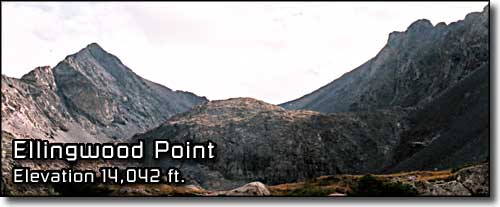
Ellingwood PointBlanca Massif - Sangre de Cristo Mountains |
||||||||||
|
|
||||||||||
 |
||||||||||
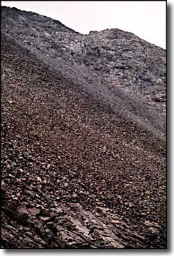
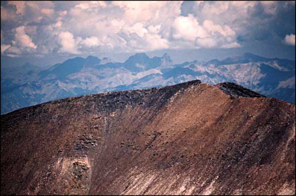
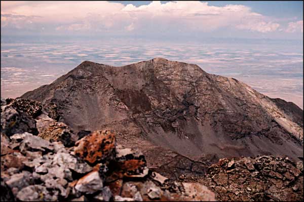
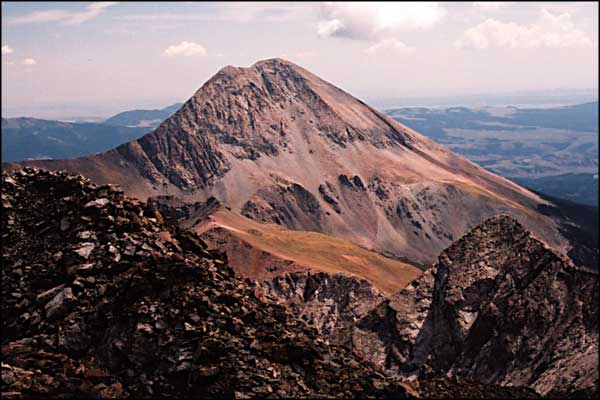
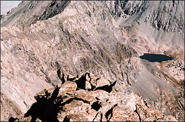
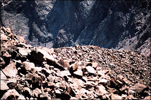
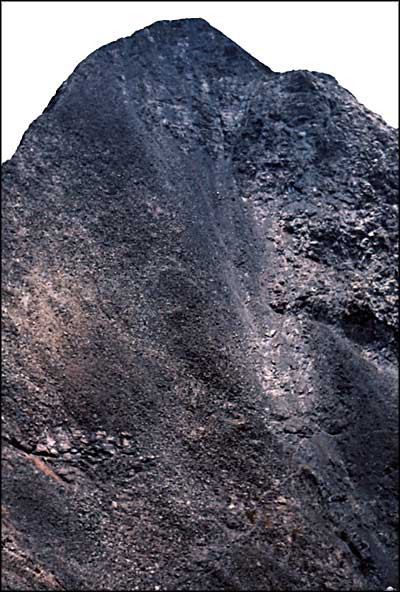
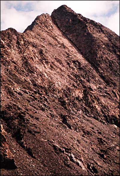
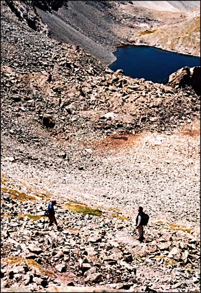
It seems most folks climb Blanca Peak and then do the traverse and climb Ellingwood. We couldn't find any indications of a trail leading directly up onto Ellingwood. The first cairn we found leading in that direction was on a ledge in the middle of the broken cliff bands. So we worked our way across the face of the ridge and then ascended to the ridge line north of the towers and cliffs. Again, the best way up the hill lay along the exposed ridge. By this time I was pretty much over my problem until we came into a notch just below the final climb to the summit. The notch had an incredible view across the north face and into Lily Lake. However, I felt the vertigo and didn't hang out any. The climbing wasn't bad and we were on the summit about 11:40 am. We had lunch, shot photos and ended up waiting for the two climbers we passed on Blanca to arrive at Ellingwood's summit. We had a good conversation with them and then started back down about 12:15. Furi started flapping his arms like a bird and I grabbed him saying, "No flying, not even Sherpas." We laughed and then he went straight down the hill with us following. Furi was picking trail and he eventually led us down onto the main trail up onto Blanca. From there it was a cakewalk back to camp. We were back about 2:20 pm. Another absolutely exquisite day in the mountains. |
||||||||||
| Clicking on any of these photos will open a new window or new tab in your browser and bring you a larger version of that photo. |
||||||||||
| ||||||||||
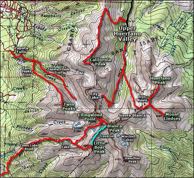 Ellingwood Point area map |
||||||||||
|
|
||||||||||
Ellingwood Point Related Pages
Blanca Peak - Little Bear Peak - Traverses - Lake Como - Mountain Stream
Mount Lindsey - California Peak - Sierra Blanca Como Lake Road - Zapata Falls National Recreation Area Rio Grande National Forest Colorado Pages
Towns & Places - Scenic Byways - State Parks - BLM Sites - History & Heritage Ski & Snowboard Areas - Photo Galleries - Colorado Mountains - Scenic Railroads Unique Natural Features - Wilderness Areas - Outdoor Sports & Recreation Colorado's National Forests - National Wildlife Refuges - Colorado's National Parks |
||||||||||

|
||||||||||
| Index - Arizona - Colorado - Idaho - Montana - Nevada - New Mexico - Utah - Wyoming National Forests - National Parks - Scenic Byways - Ski & Snowboard Areas - BLM Sites Wilderness Areas - National Wildlife Refuges - National Trails - Rural Life Advertise With Us - About This Site - Privacy Policy |
||||||||||
| Photos courtesy of Sangres.com, CCA ShareAlike 3.0 License. Map courtesy of National Geographic Topo! Text Copyright © by Sangres.com. All rights reserved. |