|
|||||||||||||
|---|---|---|---|---|---|---|---|---|---|---|---|---|---|
Blanca PeakBlanca Massif, Sangre de Cristo Mountains |
|||||||||||||
|
|
|||||||||||||
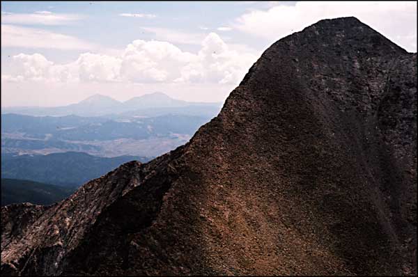
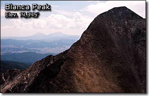 Blanca Peak, from Ellingwood Point (Spanish Peaks in the background) |
|||||||||||||
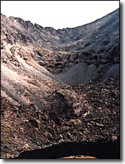
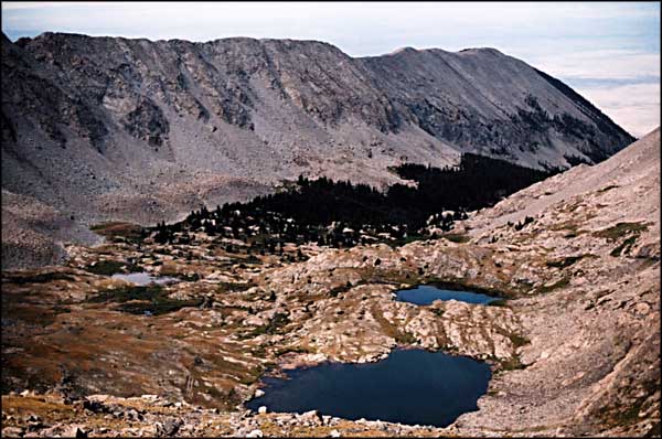
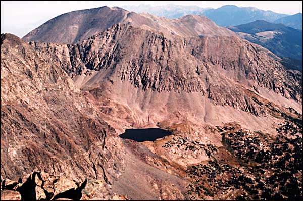
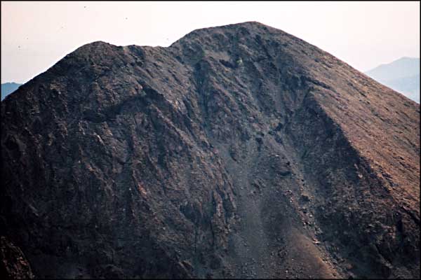
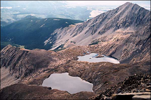
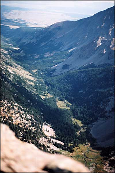
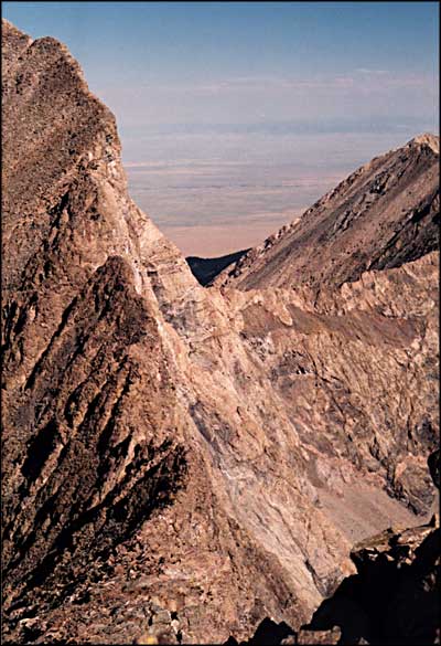
Climbing Blanca Peak was a dream I'd had for a long time. When the time finally arrived, I was up well before sunrise. It was a beautiful morning in August and it looked like we had the whole mountain to ourselves. We ate breakfast, packed day packs and left camp at 7:20 am. The trail is pretty well cairned until you come to the rock face at the very foot of the Blanca-Ellingwood ridge. The walk is beautiful with rock walls rising up everywhere you look. I found myself trying to figure how this fault-block mountain rose like this when I suddenly realized we were actually in a glacier-carved canyon. Then the sculpting of the rock fell into place. During the Ice Ages, this area was heavily glaciated. It's very similar to Yosemite Valley but at higher elevation, meaning the starkness hasn't been mitigated by living things contributing to and covering the evidence. Going up the trail we passed the Blue Lakes and climbed the hill beside the waterfall to reach the bowl of Crater Lake. Just above Crater Lake the rock face rises abruptly to the ridge connecting Blanca and Ellingwood. Also just above the lake are the remains of the gold mine buildings and a couple of worked prospects. The trail switchbacks up the rock, threading its' way through layers of broken cliffs until it comes to the boulderfield. We followed the cairns across the boulderfield. On the ridge there is a huge rock cairn and we headed directly for it. Once there we sat for a few and then walked directly up the ridge, skirting a couple of large boulders and scaling the granite where necessary. The other side of the ridge is directly above the north face, a 1000 to 1500 foot cliff. The exposure spooked me a bit but climbing the ridge wasn't bad. We arrived at the top cairn at 9:58 (Bill was keeping track). The summit has enough space for a pretty large party but it drops off in nearly every direction. There is a trail leading south along the ridge that drops down toward Hamilton Peak. The ridge that traverses from Little Bear looked exactly as it was described: the hardest of the four great mountain traverses in Colorado. We sat for a few, took lots of pictures and headed back down the ridge to make the traverse to Ellingwood about 10:20 am. Here I'm going to say I'm a total amateur at this. I have a height problem complicated by memories of a childhood fall off a shale cliff into heavy rocks. I get vertigo easily. The wind is nearly always blowing across this ridge that radically separates the lowlands to the west from the lowlands to the east. Going up the ridge wasn't bad because I was looking up at where I was going. Going down was a slightly different story. I had to stop and face my problem a couple of times. Furi read me really accurately and let me do what I needed to. We also passed a couple of climbers on their way up towards the bottom of the ridge. In the end, we were back to the large cairn pretty quickly. Then we started picking out the trail we wanted to follow to make the traverse to Ellingwood Point. |
|||||||||||||
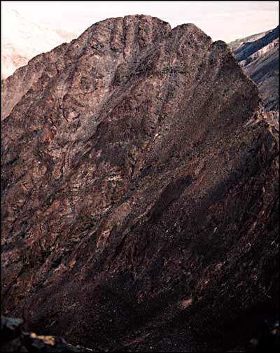
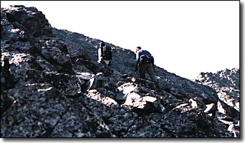 Furi and Bill picking their way through the rocks to the ridge |
|||||||||||||
| Clicking on any of these photos will open a new window or new tab in your browser and bring you a larger version of that photo. |
|||||||||||||
| |||||||||||||
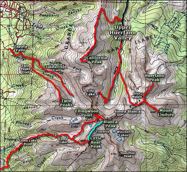 Mount Blanca area map |
|||||||||||||
|
|
|||||||||||||
Blanca Peak Related Pages
Ellingwood Point - Lake Como - Little Bear - Traverses - Sierra Blanca
California Peak - Mountain Stream - Rio Grande National Forest San Isabel National Forest - Zapata Falls National Recreation Area Colorado Pages
Towns & Places - Scenic Byways - State Parks - BLM Sites - History & Heritage Ski & Snowboard Areas - Photo Galleries - Colorado Mountains - Scenic Railroads Unique Natural Features - Wilderness Areas - Outdoor Sports & Recreation Colorado's National Forests - National Wildlife Refuges - Colorado's National Parks |
|||||||||||||

|
|||||||||||||
| Index - Arizona - Colorado - Idaho - Montana - Nevada - New Mexico - Utah - Wyoming National Forests - National Parks - Scenic Byways - Ski & Snowboard Areas - BLM Sites Wilderness Areas - National Wildlife Refuges - National Trails - Rural Life Advertise With Us - About This Site - Privacy Policy |
|||||||||||||
| Photos courtesy of Sangres.com, CCA ShareAlike 3.0 License. Map courtesy of National Geographic Topo! Text Copyright © by Sangres.com. All rights reserved. |