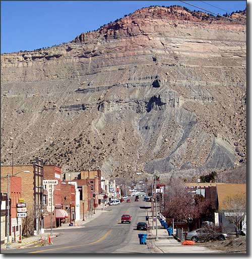
Helper, Utah

Downtown Helper, Utah
Helper was founded as a mining town in 1880 but the arrival of the Denver & Rio Grande Western Railroad in 1881-1882 is what really fueled the growth of the town. The name came from the town being located at the foot of the rise up Price Canyon to Soldier Summit: trains going west needed additional "helper" engines to make the steep grade.
The D&RGW designated Helper as a division point on the run between Ogden, Utah and Grand Junction, Colorado and built a depot, hotel and other buildings in town in 1892. Butch Cassidy and Elzy Lay stayed in Helper on the night of April 20, 1897, then they went over to Castle Gate and robbed the Pleasant Valley Coal Company the next day.
Helper grew from a mix of immigrants who came to work in the coal mines. However, like all other coal mining regions in the US in the early 1900's, labor unrest was a problem. Strikes were happening every few years and as a non-company town, Helper was in the middle of everything. With an active train depot in town, Helper was a disembarkation point for both union organizers and national guardsmen. That made for some interesting times back in those days.
As a railroad center, Helper wasn't as hard hit by the Great Depression as many other places were. Coal production rose during World War II and stayed strong into the 1960's. Then big upturns and downturns set in with a nasty bottom hit during the early 1990's. The Union Pacific Railroad owns the tracks now and Amtrak runs their California Zephyr through Helper daily in both directions (Emeryville to Chicago).
Helper is located on US Highway 6, also known as the Dinosaur Diamond Prehistoric Highway.
Latitude: 39.6885°N
Longitude: 110.8576°W
Founded: 1881; Incorporated: 1907
Elevation: 5,817'
Education:
High School or Higher: 78.0%
Bachelor's Degree or Higher: 9.8%
Graduate or Professional Degree: 3.6%
2011 Cost of Living Index for Helper: 83.3
Median Resident Age: 38.9 Years
Estimated Median Household Income: $41,650
Estimated Median Home Value: $91,500
Population Density: 1,066 People per Square Mile
Major Industries:
Educational Services, Lodging & Food Services, Mining, Utilities, Health Care, Construction, Grocery & Food Stores, Transportation Services, Government, Finance & Insurance Services, Waste Management Services
Unemployed (March 2011): 7.6%
Population Demographics: 2010
| Total Population | 2,201 |
| Males | 1,084 |
| Females | 1,117 |
| Population by Age | |
| Under 18 | 543 |
| 18 & over | 1,658 |
| 20-24 | 134 |
| 25-34 | 332 |
| 35-49 | 328 |
| 50-64 | 476 |
| 65 & over | 337 |
| Population by Ethnicity | |
| Hispanic or Latino | 296 |
| Non Hispanic or Latino | 1,905 |
| Population by Race | |
| White | 2,060 |
| African-American | 7 |
| Asian | 6 |
| Native American | 39 |
| Hawaiian or Pacific Islander | 2 |
| Other | 45 |
| Two or more | 42 |
