Casper, Wyoming

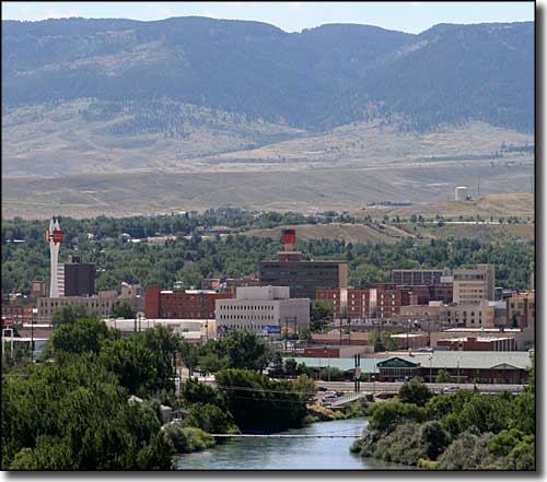
The Casper Skyline
Casper Mountain is the northernmost mountain in the Laramie Range. The City of Casper is just north of Casper Mountain, on the banks of the North Platte River. Casper has a long history of cowboy culture and of the energy production boom-and-bust cycle. The famous "Teapot Dome Scandal" of the 1920's involved the Naval Oil Reserves at Teapot Dome, about 55 miles north of Casper. Casper also figured prominently in the Johnson County War: as the nearest railhead to Johnson County, the Invaders rode from Texas to Casper in a special chartered train before disembarking and continuing on horseback.
Casper is named for a Lt. Caspar Collins, a soldier killed by Indian warriors just outside the walls of the post. Fort Caspar was abandoned in 1867 when the troops were ordered to Fort Fetterman, downstream on the North Platte near Douglas, along the Bozeman [Montana] Trail.
The settlement at Casper was founded east of the site of the fort several years later, in anticipation of the arrival of the railroad. The first oil field discovered near Casper was the Salt Creek Oil Field in 1889. That began Casper's long love/hate affair with the energy industry. The first oil refinery in Casper was built in 1895. Refineries have been built, operated and closed over the years but there's been at least one operating in the city or nearby since 1895. Casper is also in the center of the Wyoming coal and uranium mining industries. The area around Casper used to be very large on sheep but that has dropped off over the years, although the railhead still ships a lot of wool and a lot of sheep every year.
Zip Codes: 82601, 82602, 82604, 82605, 82609, 82615, 82630, 82638, 82646
Latitude: 42.8347°N
Longitude: 106.3251°W
Elevation: 5,150'
Education:
High School or Higher: 89.1%
Bachelor's Degree or Higher: 22.1%
Graduate or Professional Degree: 7.3%
2011 Cost of Living Index for Casper: 80.6
Median Resident Age: 36.1 Years
Estimated Median Household Income: $54,200
Estimated Median Home Value: $184,700
Population Density: 2,237 People per Square Mile
Major Industries:
Health Care, Construction, Educational Services, Mining, Energy Production, Government, Professional Services, Lodging & Food Services, Social Services, Finance & Insurance Services
Unemployed (March 2011): 6.0%
Population Demographics: 2010
| Total Population | 55,316 |
| Males | 27,517 |
| Females | 27,799 |
| Population by Age | |
| Under 18 | 13,222 |
| 18 & over | 42,094 |
| 20-24 | 3,968 |
| 25-34 | 8,119 |
| 35-49 | 10,419 |
| 50-64 | 10,847 |
| 65 & over | 7,116 |
| Population by Ethnicity | |
| Hispanic or Latino | 4,070 |
| Non Hispanic or Latino | 51,246 |
| Population by Race | |
| White | 51,048 |
| African-American | 560 |
| Asian | 436 |
| Native American | 521 |
| Hawaiian or Pacific Islander | 26 |
| Other | 1,295 |
| Two or more | 1,430 |
South Big Horn-Red Wall Scenic Back Country Byway - Hogadon Ski Area
