Swift Trail Parkway

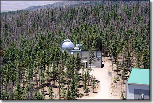
The site of the Vatican Advanced Technology Telescope, near the summit of Mt. Graham
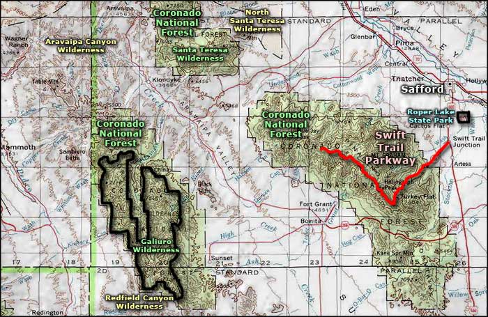
The Swift Trail Parkway climbs the side of Mt. Graham in the Pinaleno Mountains southwest of Safford. In 26 miles, the road rises about 6,000' as it gains the top ridge of the Pinalenos and then follows that ridge for several miles before ending at Riggs Flat Lake, an often-stocked 11-acre trout lake. Along that top ridge you'll also pass by several astronomical observatories, including the Vatican Advanced Technology Telescope, funded and operated by the Vatican.
Figure on taking at least 90 minutes to drive this sharply-twisting and windy road from the junction with US Highway 191 to the end of the road. The beginning of the journey is through typical Sonoran desert scrub: paloverde, mesquite, cholla, prickly pear, yucca and some saguaro. Then as you start to climb, you'll move into desert grasslands, then dense oak, sage, and manzanita. Above that you'll come to thick stands of Ponderosa pine, Douglas fir, aspen and spruce. These upper forests are what remain of the Pleistocene conifer forests that covered this whole area during the last Ice Age. The higher mountains are high enough, cool enough and wet enough to still sustain those ancient woodlands. That's what makes this a "sky island."
As nearly the entire Swift Trail Parkway is within the Coronado National Forest, there are campgrounds, picnic areas and hiking trails all along the way. There's even a series dispersed campsites around Riggs Flat Lake at the end of the road. This area gets a lot of visitors in the summer but most folks try to come here during the spring and fall bird migrations when up to 300 species pass through these woods on their way to somewhere else.
The Swift Trail Parkway is paved until you reach mile post 22, where it turns to dirt and graded gravel for the last 4 miles. There's a gate at mile post 22 that the Forest Service uses to close off the rest of the road in winter.

Swift Trail Parkway area map
