Santa Teresa Wilderness

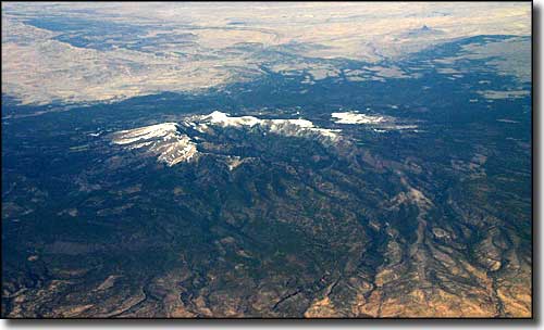
The Santa Teresa Mountains
The Santa Teresa Mountains are a remote and rugged network of bald mountains and sprawling mesas separated by deep canyons. Elevations start below 4,000' and rise to 7,481' at the top of Cottonwood Peak. The Santa Teresa Wilderness is an extremely rugged 26,780-acre property sandwiched between the Aravaipa Canyon Wilderness on the west and the San Carlos Apache Indian Reservation on the east, with the BLM's North Santa Teresa Wilderness on the north.
Most of the Santa Teresa Wilderness is covered with a thick chaparral vegetation with Ponderosa pines and Douglas firs on the north slopes and along the crest of Cottonwood Peak. You'll find mountain lions, javelinas, coatimundis and black bears here. The canyons sport tall, colorful cliffs with caves and alcoves eroded into them. There are a few springs in the wilderness that flow year round, but as drinking water sources they are unreliable. There are several hard-to-follow foot trails (forget signage) leading to some interesting places in the Wilderness but maintenance is spotty at best and human use is very light. The trails that seem best maintained are most probably routes by which the local cowboys drive their livestock through. Major access points are at the ends of FR's 679, 677 and 277.
USGS Quads: Jackson Mountain, Klondyke, Cobre Grande Mountain, Buford Hill.

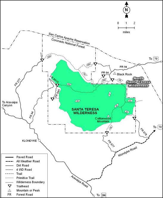
Santa Teresa Wilderness trail map

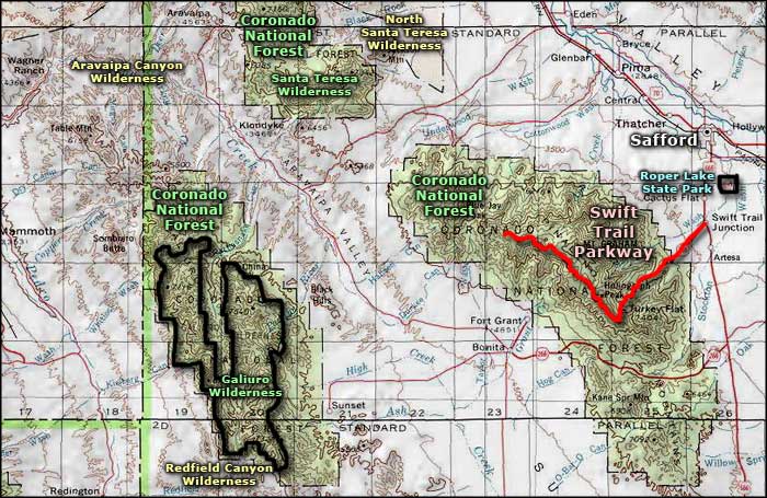
Santa Teresa Wilderness area map
