At the intersection of US 160 and Main Street in Walsenburg, the Scenic Highway of Legends route turns right and goes southerly directly out of town to the intersection with the I-25. To return to Trinidad, take the right just before the bridge (look out for the frontage road just before it). To head north, just cross the bridge and take the first left onto the I-25 Northbound. This page covers the Interstate part of the Scenic Byway route from Walsenburg past Aguilar to Trinidad.

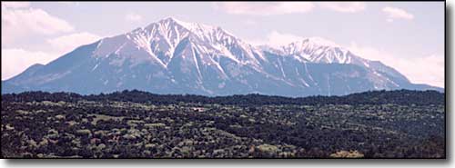
Greenhorn Mountain to the north, from near Exit 41

Sandstone bluffs, Fisher's Peak and Raton Mesa to the south,
from near Exit 41
Exit 42 leads to Pryor (includes Monson and Rouse). Exit 41 is for Rugby. These towns were coal camps back in the day but now, for the most part, there is nothing left but crumbling footings and foundations. Thousands of people lived and worked in the hills just behind those that front on the Interstate during the time period between 1890 and 1960. Railroad tracks ran between the coke ovens built in the mouths of the canyons all up and down the rise of sandstone bluffs between Walsenburg and Trinidad. Most of the mines were up those canyons but few were visited by train tracks.
Exit 34 is the northern exit for Aguilar and the Scenic Highway of Legends' Apishapa Road. East of here is the Foster House, an old stage stop from Civil War times. Exit 30 is the southern exit for Aguilar and the Scenic Highway of Legends. East of this area, the "Hogback" is easily seen. The Hogback is one of the Great Dikes that runs east of the mountains and onto the plains.
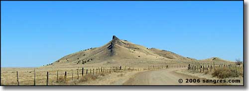
The Aguilar Hogback, from just east of the I-25
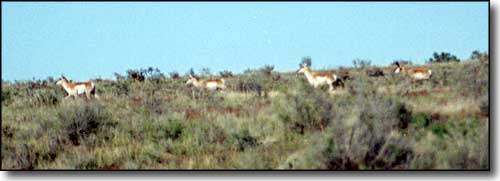
Along the way you'll probably see Pronghorns in the flatter areas
For many years the working conditions in those coal mines were horrific. The mines were full of methane gas and almost every year brought stories of another mine exploding at great loss of life for the miners themselves, but everyone lived in a company town. If the husband wasn't on the payroll of the mine (and death is a form of job termination), the family was tossed out to make room for the husband's replacement. This led to many stories of children living and begging in the streets of the larger towns while their mothers toiled in the brothels and cribs in the red light districts. But looking at this countryside now, you'd never know it. If you'd like to know more, visit the Ludlow Massacre Memorial, just west of Exit 27. The Ludlow Memorial honors events that transpired during the Colorado Coalfield War of 1913-14, when 20 innocent people were killed one day by state militiamen supporting the coal mine owners.
If you go past the Memorial and up Del Agua Canyon, you'll soon come to a set of defunct coke ovens. If you turn left at the Memorial you'll go past the remains of the company town at Ludlow. Another mile further and go right under the tracks brings you into Berwind Canyon: a beautiful place littered with the remains of several large coal camps. Follow that road far enough and you'll come to Reilly Canyon, then Boncarbo, and stay left to Cokedale, back at the Scenic Highway of Legends west of Trinidad.
Eight miles east of Exit 23 is the farming community of Hoehne. Down in the valley of the Purgatoire, Hoehne, like the rest of Las Animas County, was once a more populous community. When most of the last coal mines in the area shut down during the recession of 1955-56, many jobs went away. Many of the people went with them. Just east of Hoehne, off the US 350, is the Perry Stokes Airport, the Las Animas County airport. Perry Stokes saw daily service from TWA up until 1956. Today the largest user is the US Army, the second being UPS.
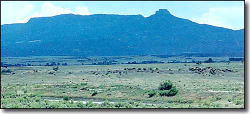
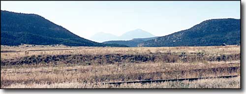
Fisher's Peak and Raton Mesa, from near Exit 23
Just north of Trinidad at Exit 18 is the Trinidad-Las Animas County Industrial Park and El Moro Rest Area. Just north of Exit 15 is where the city really begins. To return full circle to the beginning of the Scenic Highway of Legends, go to Exit 13A, Main Street, and follow the signs to the Colorado Welcome Center.
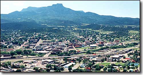
Trinidad from Simpson's Rest. That's Exit 13B on the extreme right,
Main Street, Trinidad, leading almost directly to the Scenic Highway of Legends.
