
Aguilar, Colorado
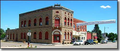
Ringo's Groceries and Liquor Store, Main Street, Aguilar
Aguilar is situated in the heart of the Apishapa River Valley in south central Colorado, midway between Trinidad and Walsenburg. The dry exhilirating climate in the Aguilar area makes for healthful, happy living with its' restful, sleep-inducing cool nights and warm (but not hot) sunny days. County Road 46.0 goes through town and then west past Gulnare and leads to the top of Cordova Pass (elevation 11,205 feet) over which towers the West Spanish Peak (elevation 13,656 feet), flanked on the west by the Culebra Range of the snow-capped Sangre de Cristo Mountains. A well marked timber trail through the San Isabel National Forest leads to the top of the West Spanish Peak. It is rugged climbing but it affords a magnificent and unforgetable view of the vast countryside below.
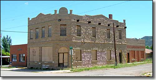
What's left of the Aguilar State Bank, although the building's fate is now in the hands of the Colorado Historical Society
County Road 46.0 is also known as the Apishapa Road and has recently been incorporated into the Scenic Highway of Legends Byway. This does not mean that the snow will be plowed through the National Forest section over Cordova Pass, that part of the road is usually snow-blocked from mid-November until late May.
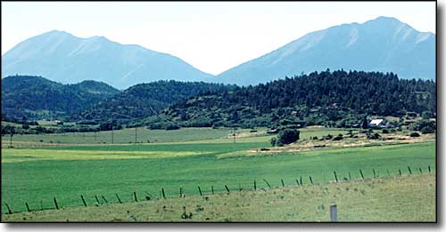
The Spanish Peaks rise west of Aguilar
Aguilar was first settled in 1861, as "San Antonio Plaza", mainly a trading post for Native Americans and Spanish American farmers. In 1878 the railroad came through and opportunities blossomed. J. Ramon Aguilar owned the land on which the town now stands and the town was named for him in 1888, although Aguilar wasn't incorporated until 1894.
In 1888, the Peerless Coal Mine opened and initiated the "Industrial Boom" that built Aguilar into a metropolis of 2,500 plus, with many miners and their families living in numerous coal camps around town. With 3 large mines immediately adjacent to town, the weekly payroll of the area was some $90,000. On the other hand, these were mostly immigrant families who shared a common goal of helping each other through the loneliness of the new country, surviving the horrendous working conditions and trying to get by on the horrible pay. Many of these workers lived in company housing and were paid in company scrip (which could only be used in the company store). To the immigrant workers, Aguilar offered freedom and a civilized warmth next to the living and working conditions in the coal camps: Aguilar itself wasn't directly under the thumb of the coal companies.
Aguilar and the Apishapa River Valley had quite a reputation for bootlegging during the years of Prohibition. The area was also known as a place for Mob hit men to come and cool off after doing a "job." There is a story circulating about a wedding in Aguilar in the 1920's. Seems two of the celebrated guests were Joe Bananas and Al Capone.
Aguilar was a prosperous town until the coal mines began shutting down in the 1940's and 1950's. As the mines closed, the market for foodstuffs provided by farmers along the Apishapa River Valley dried up and many of those farmers moved on. Now, the population of Aguilar is around 600, the lights are still on... and new businesses are opening on Main Street. Things are starting to look up again.

The new Aguilar Schools were opened in November, 2005.
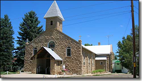
St. Anthony Church
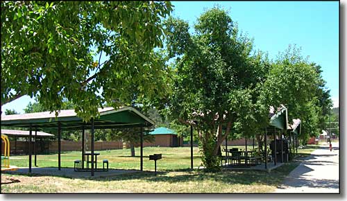
Aguilar Town Park, site of the Aguilar Days Celebration: second weekend of August every year
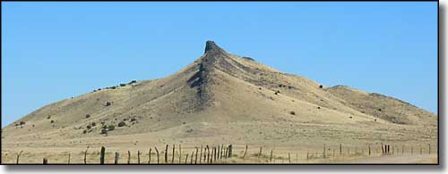
The Aguilar Hogback, a natural landmark several miles east of town
Latitude: 37.4033°N
Longitude: 104.6544°W
Incorporated: January 10, 1894
Elevation: 6,394'
Education:
High School or higher: 72.5%
Bachelor's Degree or higher: 9.6%
Graduate or Professional Degree: 3.5%
2011 Cost of Living Index for Aguilar: 90.9
Estimated median household income: $33,600
Estimated median home value: $85,200
Median resident age: 45.0 years
Major Industries:
Health Care, Education, Government, Construction, Lodging & Food Services, Waste Management & Support, Agriculture, Social Services, Rail Transportation
Unemployed (March 2011): 10.3%
Population Demographics: 2010
| Total Population | 538 |
| Males | 258 |
| Females | 280 |
| Population by Age | |
| Under 18 | 114 |
| 18 & over | 424 |
| 20-24 | 20 |
| 25-34 | 44 |
| 35-49 | 87 |
| 50-64 | 126 |
| 65 & over | 127 |
| Population by Ethnicity | |
| Hispanic or Latino | 248 |
| Non Hispanic or Latino | 290 |
| Population by Race | |
| White | 432 |
| African-American | 1 |
| Asian | 0 |
| Native American | 25 |
| Hawaiian or Pacific Islander | 0 |
| Other | 60 |
| Two or more | 20 |
Starkville - Stonewall - Trinidad - Weston - Las Animas County
Scenic Highway of Legends - Historic Plazas - State Trust Lands & Wildlife Areas
Bosque del Oso SWA - Spanish Peaks SWA - North Lake & North Fork SWA
Lake Dorothey SWA - San Isabel National Forest - Spanish Peaks Wilderness
Trinidad Lake State Park
National Park Service Sites - BLM Sites - National Wilderness Areas - Unique Natural Features
Outdoor Sports & Recreation - Ski & Snowboard Areas - Photo Galleries - Colorado Mountains
