Sangre de Cristo Wilderness

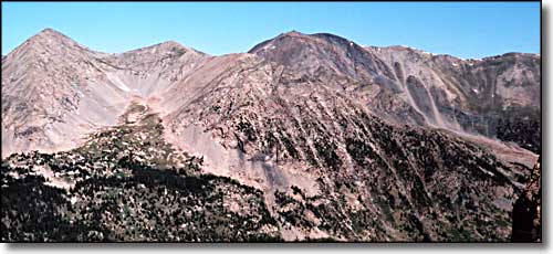
Looking up inside the Sangre de Cristo Wilderness Area (California Peak in the center)
The Sangre de Cristo Wilderness Preservation Area encompasses 228,044 acres in the Sangre de Cristo Mountains. This range is located in south-central Colorado, within the San Isabel and Rio Grande National Forests. The Wet Mountain Valley borders this wilderness (to the east) and the San Luis Valley (to the west). The towns of Salida (north), La Veta (south), Westcliffe (east), Saguache (west) and Crestone (west), all border this mountain range.
The Sangre de Cristo Wilderness is one of the youngest in Colorado. Designated in 1993, this area has over 60 alpine lakes, 400 miles of streams and nearly 400 miles of trails. Sangre de Cristo is Spanish for “Blood of Christ”. According to legend, a Spanish Priest, Father Francisco, was mortally wounded by an Indian’s arrow. In his dying moments, Father Francisco raised himself on his elbow, viewed the setting sun’s red glow on the mountain range and gasped, “Sangre de Cristo.”
When the Spanish Conquistadors arrived in the 16th and 17th centuries, they found Ute, Comanche, Navajo and Pueblo peoples had been living in the region for many years. To encourage frontier settlement, Spain, and later independent Mexico, granted enormous tracts of land to influential and enterprising citizens with the stipulation that those grants be settled by people. The land grants did well, for the most part, until the United States Congress required that their representatives appear in front of Congress in 1860 and prove they were the rightful owners of the land. That cost a lot of people the property they had been living and raising their families on for 30 and 40 years. At the same time, it opened up a lot of territory for the government to sell that land to new settlers.
By the 1880’s, American ranches and railroads flanked the Sangre de Cristo range. Over one million head of cattle and sheep grazed the San Luis, Huerfano and Wet Mountain Valleys, moving up into the high mountains for summer pasture. During this time, Rocky Mountain elk, bighorn sheep, and beaver nearly disappeared and grizzly bears were almost wiped clean from the mountains of Colorado. Between 1860 and 1910, fires were purposely set, burning most of the forest to increase summer sheep pastures, expose minerals or produce charcoal. The glorious aspen glades we see today owe their origins to this period of burning. In 1902 a major portion of the Sangre de Cristo's was set aside as the San Isabel Forest Reserve. The Reserve later became the San Isabel and Rio Grande National Forests, managed by the U.S. Forest Service. In 1993, Congress designated the Sangre de Cristo Wilderness with the backbone of the mountain chain in the center of it.
In the heart of the Wilderness is Crestone Peak, Crestone Needle, Kit Carson Peak, and Humboldt Peak, four of Colorado's 54 "14er's." In the area around these peaks you can expect to see heavy traffic nearly all year round (folks "bagging" peaks, ya know...) South of there in the Upper Huerfano Valley you'll come up close to 4 more 14er's (Blanca Peak, Ellingwood Point, Mt. Lindsey, and Little Bear) and see similar traffic problems. But once you get away from these particular peaks, the woods are pretty empty. There's a number of trails up into the mountains but most lead to high altitude lakes that sit below virtually unclimbable, glacier-carved walls. To say it's beautiful is to not do it justice.
With increasing visitor use in the Sangre de Cristo Wilderness, the Forest Service is considering a self-issuing permit system. For more information, please contact the San Carlos Ranger District (719) 269-8500.
To return, use the back button of your browser.

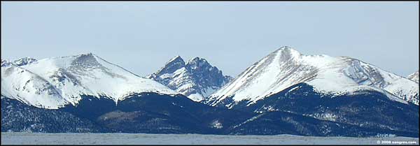
Crestone Peak and Needle in the center, Humboldt Peak to the right

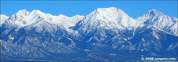
Kit Carson Mountain just right of center
National Park Service Sites - BLM Sites - National Wilderness Areas - Unique Natural Features
Outdoor Sports & Recreation - Ski & Snowboard Areas - Photo Galleries - Colorado Mountains
