 |
Volcanic Plugs, Buttes and Cones |
|
|
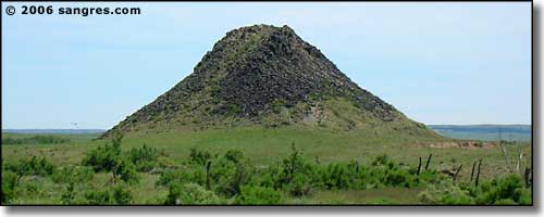 Huerfano Butte was a landmark long before Santa Fe Trail days |
|
Huerfano County has been described as "a broken, tilted and eroded plateau bridging the mountains and the high plains." Most of the tilting we see today occurred about 27 million years ago, during the Sangre de Cristo upthrust. That tilted the county higher in the west and it was the generally easterly flow of runoff that has caused the surface erosion we see now. For whatever reason, though, the fault lines that allowed for the fault block uplift also run through western Huerfano County, but there was a break in the rock being pushed up from around the south side of La Veta Pass to around the north side of Medano Pass. West of the fault lines in that area is that chunk of pre-Cambrian rock we know as the Blanca Massif, with Mt. Lindsey, Huerfano Peak and the area over into the Grayback Mining District (south of Malachite, east of Pass Creek). Pass Creek Road actually looks as though it follows a fault line or two in its' beautiful journey through that back country. Perhaps that pre-Cambrian granite, like an iceberg, shows only its' tip above ground and a bulge of it below ground is what prevented the upthrust of the Sangre de Cristo's in this immediate area. In the gap between La Veta Pass and Medano Pass there was a jet of magma pushing up and about 25 million years ago this solidified in open holes and vertical cracks in the sub-surface of the Earth's crust and formed the Spanish Peaks-White Mountains group (and the associated radial dike system) and the Mt. Mestas-Rough Mountain-Silver Mountain-Sheep Mountains group (and the associated radial dike system). The same intrusion of magma also created Goemmer Butte, Gardner Butte, Huerfano Butte, Badito Cone, the Black Hills, and the pile of rock atop Greenhorn Mountain (about 25 million years old versus 1.7 billion years for the rock that makes up the whole rest of the mountain chain). I was fortunate enough to be at the foot of the rock face on Greenhorn Mountain one morning at sunrise and I watched the western horizon turn red, then pink, then grey as the sun's rays shone more on the peaks over time. At the same time, in the shadows below I could see the twisting and folding of the surface of the Earth around that bubble of magma that became the Silver Mountain-Mt. Mestas-Sheep Mountains complex and is now part of the Huerfano River drainage. All of the buttes are volcanic plugs: the magma may have been flowing up a vent towards the surface but it solidified in the form of a plug and that stopped the motion. Goemmer Butte is in the valley between the West Spanish Peak and the Sangre de Cristo's. Gardner Butte is in the valley between the Mt. Mestas-Silver Mountain-Sheep Mountains group and Greenhorn Mountain. To be different, Huerfano Butte is on the edge of the high plains, southeast of the foot of Greenhorn Mountain, just below the south shore of the Huerfano River. And Badito Cone is actually a conical high point on a dike formation pointed directly uphill at the tops of Greenhorn Mountain. |
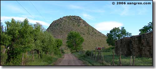 Huerfano Butte from the north 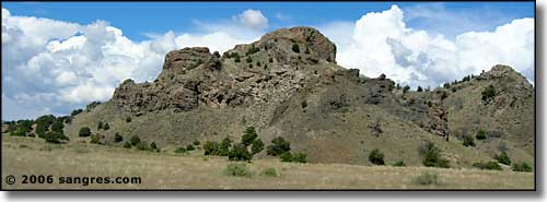 Gardner Butte, from the northwest 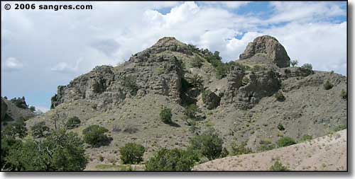 Gardner Butte, from the south 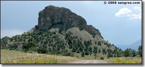 Gardner Butte, from the northeast 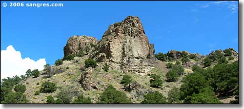 Gardner Butte, from the southwest 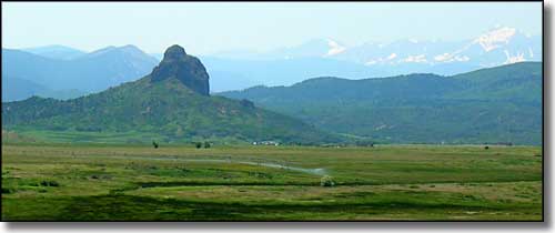 Looking south at Goemmer Butte on a hazy summer day 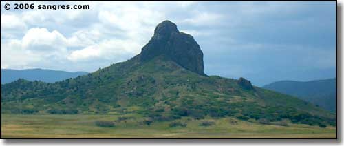 Closer to Goemmer Butte |
|
On his excellent website, Brian Penn goes into detail about the formation of some of these geological features, complete with maps, photos, and timelines for the forming of certain features and flows of magma (the East Spanish Peak was formed by two igneous intrusions...) |
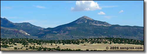 Badito Cone, from the northwest 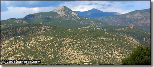 Badito Cone, with South Greenhorn Mountain behind |
|
In the old days, traveler's on the Trapper's (or Taos) Trail looked for Badito Cone as a trail marker, that's how the settlement at Badito happened: where the trail left the river (right below the cone) and headed west up Oak Creek and over Sangre de Cristo Pass to the San Luis Valley and Taos. Later, traveler's on the San Luis Valley branch of the Santa Fe Trail looked for Huerfano Butte as a trail marker. At one time, there was a busy hotel, saloon and post office located beside the Huerfano River, just north of the butte. The Black Hills are an area where the igneous intrusion doesn't appear as dikes or as plugs but as a series of ragged hills. If you want to get the real view as to what all of this things look like, in real time, take a trip some early morning: find your way to Greenhorn Mountain Road and follow it to the southern end. You'll be on a shelf of pre-Cambrian granite there, looking out over all of western Huerfano County. Sunrise is a great time to be there and watch the sun slowly creeping down the faces of the Sangre de Cristo's along the western horizon. All too quickly, that sunrise floods down onto the more level surfaces of the county but then, in the shadows, you can see the folds and bends in the ground itself, around most of these plugs, buttes and cones and around the igneous intrusion that is the Mt. Mestas-Silver Mountain-Sheeps group. And if you turn around and look at the rockface that makes up the tops of Greenhorn, you are looking at the same igneous material, only this plume of magma came up through the ancient granite and not through layers of various sandstones and coals. One more note: when the molten rock solidified to create all of these formations, even the tops of the Spanish Peaks were several miles underground. Everything we see today has been exposed by 25 million years of very slow but continued uplift and 25 million years of extensive erosion by the elements. |
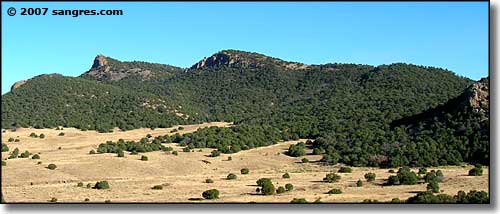 The Black Hills 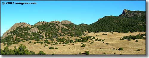 |
|
|
Related Pages
The Spanish Peaks - Great Dikes - Mt. Mestas - Silver Mountain - The Sheep Mountains
Greenhorn Mountain - Sangre de Cristo Mountains Colorado Pages
Towns & Places - Scenic Byways - State Parks - BLM Sites - History & Heritage
Ski & Snowboard Areas - Photo Galleries - Colorado Mountains - Scenic Railroads Unique Natural Features - Wilderness Areas - Outdoor Sports & Recreation Colorado's National Forests - National Wildlife Refuges - Colorado's National Parks |
 |
| Index - Arizona - Colorado - Idaho - Montana - Nevada - New Mexico - Utah - Wyoming National Forests - National Parks - Scenic Byways - Ski & Snowboard Areas - BLM Sites Wilderness Areas - National Wildlife Refuges - National Trails - Rural Life Sponsor Sangres.com - About Sangres.com - Privacy Policy - Accessibility |
| Photos courtesy of Sangres.com, CCA ShareAlike 3.0 License. All text Copyright © by Sangres.com. All rights reserved. |