 |
Sleeping Giant Wilderness Study Area |
 The Sleeping Giant |
|
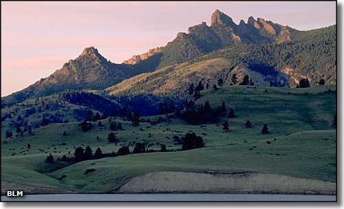
The Sleeping Giant Wilderness Study Area contains about 11,000 acres with elevations ranging from about 3,600' to about 6,800' in a steep and irregular topography, about half of which is forested. Visible from Helena, the Sleeping Giant formation itself is a prominent and well-known landmark. There are 7 miles of ridgeline hiking routes that offer some spectacular views of the Rocky Mountains to the west. High in the hills you'll find a healthy population of mountain goats and bighorn sheep, lower down you'll come across mule deer, elk and black bear. You'll also often see osprey and golden eagle in the sky. Along the Holter Lake shoreline there are about 40 primitive campsites available. Near the Missouri River you'll find the deteriorating remains of several old homesteads. Part of the Sleeping Giant Wilderness Study Area is also part of the Lewis and Clark National Historic Trail. On Wood Siding Gulch Road there are 2 small trailheads that give access to the area. Hikers, primitive campers, wildlife watchers, sightseers and anglers are welcome. To get here: Take the Wolf Creek exit from the I-15 (exit 226) and go about 5 miles to the BLM Wood Siding Gulch Road. Parking and trailhead areas are signed. The Sleeping Giant Wilderness Study Area is also adjacent to the Holter Lake Recreation Area and access can be attained from there. There are no fees involved and the property tends to accessible from mid-June to December. |
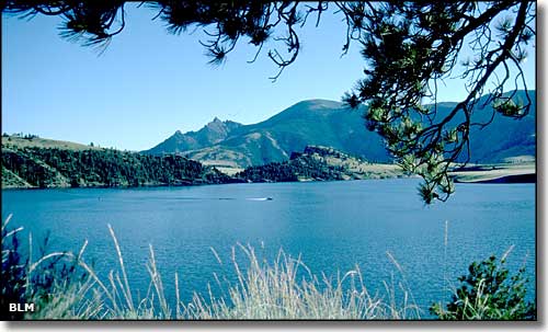 Looking across Holter Lake to the Sleeping Giant 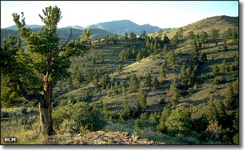 In the Sleeping Giant Wilderness Study Area 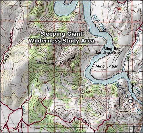 Sleeping Giant Wilderness Study Area map 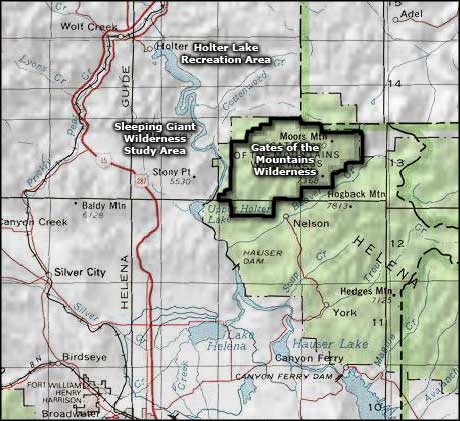 Sleeping Giant Wilderness Study Area area map |
|
|
 |
| Index - Arizona - Colorado - Idaho - Montana - Nevada - New Mexico - Utah - Wyoming National Forests - National Parks - Scenic Byways - Ski & Snowboard Areas - BLM Sites Wilderness Areas - National Wildlife Refuges - National Trails - Rural Life Advertise With Us - About This Site - Privacy Policy |
| Photos of the Sleeping Giant Wilderness Study Area are courtesy of the Bureau of Land Management Maps courtesy of National Geographic Topo! Text Copyright © by Sangres.com. All rights reserved. |