 |
Gates of the Mountains Wilderness |
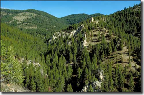 Gates of the Mountains Wilderness |
|
Gates of the Mountains was named by Meriwether Lewis, and is one of the most widely recognized landmarks of the Lewis and Clark Expedition. "From the singular appearance of this place I called it the gates of the mountains," is what he wrote in his journal. The Congressionally designated Gates of the Mountains Wilderness contains some 28,562 acres rising to the southeast of Holter Lake in the Big Belt Mountains. There are several points in the Beaver Creek drainage near the ghost town of Nelson that allow access to the 53 miles of developed trails in Gates of the Mountains Wilderness. While some of these trails are in the lower, more barren areas, most of them rise up through large parks and timbered areas into the Big Belt Mountains. And just because this is beside and above the Missouri River doesn't mean there's much water back in those hills... Geologically speaking, the prominent gray cliffs visible along the Missouri River in this area are composed of Madison Limestone. In many areas of the river canyon, Greyson Shale was pushed up over the Madison Limestone during the Sevier Orogeny (which partially overlapped with the mountain-building action of the Laramide Orogeny, although the Sevier Orogeny action was more to the west of the Laramide Orogeny action, and the Sevier's compressional activity took advantage of the weak bedding planes left in the overlying sedimentary rock layers and created thrust faults as opposed to the Laramide's massive basement-rock uplifts that occurred along pre-existing ground faults). The river canyon itself, though, is an example of an "antecedant stream": the river was here before the rock was uplifted and the erosional action of the flowing water kept pace with the rising of the rock as that uplift occurred. |
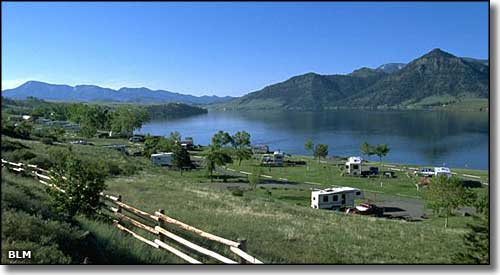 Holter Lake, with Gates of the Mountains Wilderness on the left in the distance 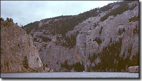 Madison Limestone walls rise above the Missouri River in Gates of the Mountains Wilderness 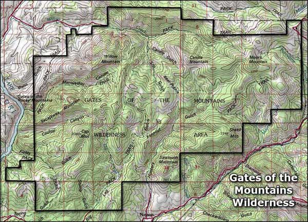 Gates of the Mountains Wilderness map 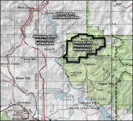 Gates of the Mountains Wilderness area map |
|
|
 |
| Index - Arizona - Colorado - Idaho - Montana - Nevada - New Mexico - Utah - Wyoming National Forests - National Parks - Scenic Byways - Ski & Snowboard Areas - BLM Sites Wilderness Areas - National Wildlife Refuges - National Trails - Rural Life Advertise With Us - About This Site - Privacy Policy |
| Upper photo courtesy of Steve Boutcher, via Wilderness.net Photo of Holter Lake courtesy of the Bureau of Land Management Bottom photo courtesy of Richard I. Gibson, CCA ShareAlike 3.0 License. Maps courtesy of National Geographic Topo! Text Copyright © by Sangres.com. All rights reserved. |