 |
Mount Wilson Back Country Byway |
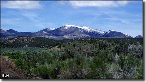 The White Rock Range from the Mount Wilson Backcountry Byway |
|
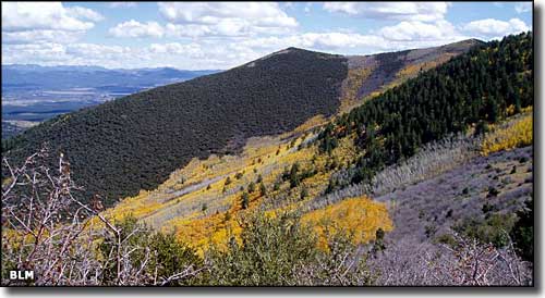
The Mount Wilson Back Country Byway travels a route east of US Highway 93 between Pony Springs and Pioche. Along the way this 66-mile route passes by Spring Valley and Echo Canyon State Parks and travels between the White Rock Range and Parsnip Peak Wilderness Areas as it makes its way around the Wilson Range. This is an area of ancient volcanic calderas now overgrown with junipers and pinons. The higher areas are a mix of Ponderosa and aspen. There's wildlife and views galore, just bring your high clearance vehicle and a good camera and you'll have a good time. |
 Parsnip Peak Wilderness 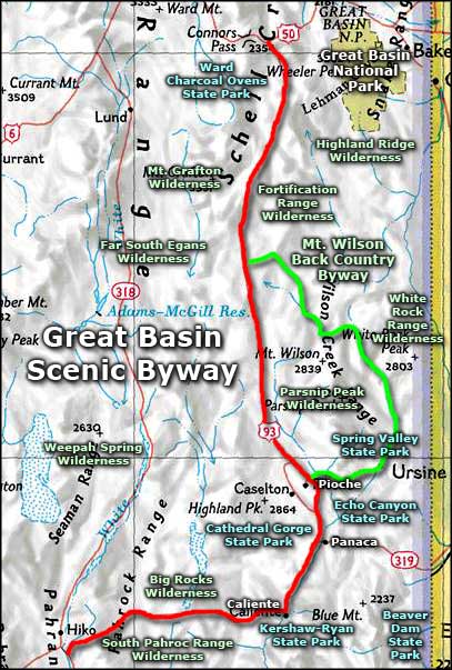 Mount Wilson Back Country Byway area map |
|
|
Mount Wilson Back Country Byway Related Pages
Ward Charcoal Ovens State Park - Spring Valley State Park - Echo Canyon State Park
Cathedral Gorge State Park - Kershaw-Ryan State Park - Beaver Dam State Park Great Basin Scenic Byway - Great Basin National Park - Parsnip Peak Wilderness Highland Ridge Wilderness - Mount Grafton Wilderness - Fortification Range Wilderness White Rock Range Wilderness - Far South Egans Wilderness - Tunnel Spring Wilderness Weepah Spring Wilderness - Big Rocks Wilderness - South Pahroc Range Wilderness Nevada Pages |

|
| Index - Arizona - Colorado - Idaho - Montana - Nevada - New Mexico - Utah - Wyoming National Forests - National Parks - Scenic Byways - Ski & Snowboard Areas - BLM Sites Wilderness Areas - National Wildlife Refuges - National Trails - Rural Life Advertise With Us - About This Site - Privacy Policy |
| Photos are courtesy of the Bureau of Land Management. Map courtesy of National Geographic Topo! Text Copyright © by Sangres.com. All rights reserved. |