 |
Great Basin Scenic Byway |
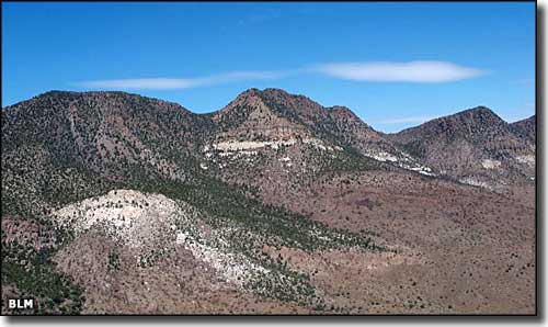 Looking north from Pahroc Summit at Big Rocks Wilderness |
|
The Great Basin Scenic Byway is a 148-mile crossing of high desert by US 93 between Crystal Springs and Ely. This stretch of countryside is just west of Great Basin National Park and passes by Beaver Dam, Cathedral Gorge, Cave Lake, Echo Canyon, Kershaw-Ryan, Spring Valley and Ward Charcoal Ovens State Parks. You'll also pass by the Mount Grafton Wilderness to the west and the Fortification Range Wilderness to the east. Between Caliente and Crystal Springs, the Big Rocks Wilderness is to the north of Pahroc Summit while the South Pahroc Range Wilderness is to the south. There's ghost towns, lots of tumbleweed and sites to visit like the "Million Dollar Courthouse" in Pioche. During the big gold and silver mining days, some of these towns were among the West's most deadly and notorious. Some of them are among the earliest settlements in Nevada. Lots of history out here, some of it going back 10,000 years and more... and when you get to Crystal Springs, make the turn west onto SR 375 (the Extraterrestrial Highway)... or at Ely follow US 50 west (the Loneliest Road in America). And just because this isn't the Loneliest Road in America doesn't mean you don't have to keep an eye on your gas gauge... it's a long way between gas stations in this country. |
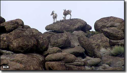 In the South Pahroc Range Wilderness 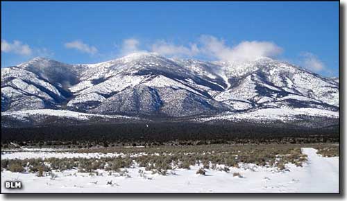 Mount Grafton from the highway 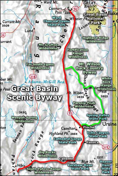 Great Basin Scenic Byway area map |
|
|
Great Basin Scenic Byway Related Pages
Mt. Wilson Back Country Byway - Extraterrestrial Highway - Loneliest Road in America
Ward Charcoal Ovens State Park - Beaver Dam State Park - Kershaw-Ryan State Park Spring Valley State Park - Echo Canyon State Park - Cathedral Gorge State Park Great Basin National Park - Highland Ridge Wilderness - Weepah Spring Wilderness Fortification Range Wilderness - Mount Grafton Wilderness - Parsnip Peak Wilderness White Rock Range Wilderness - Far South Egans Wilderness - Tunnel Spring Wilderness Big Rocks Wilderness - South Pahroc Range Wilderness Nevada Pages |

|
| Index - Arizona - Colorado - Idaho - Montana - Nevada - New Mexico - Utah - Wyoming National Forests - National Parks - Scenic Byways - Ski & Snowboard Areas - BLM Sites Wilderness Areas - National Wildlife Refuges - National Trails - Rural Life Advertise With Us - About This Site - Privacy Policy |
| Photos courtesy of the Bureau of Land Management. Area map courtesy of National Geographic Topo! Text Copyright © by Sangres.com. All rights reserved. |